Search This Blog

Showing posts with label climate change. Show all posts

Tuesday, January 6, 2015

The USDA Climate Hubs: Almost One Year Old and Making Progress

From USDA:


The USDA Climate Hubs are almost one year old!  Since February of 2014, we have made considerable progress by developing networks that connect researchers to landowners; by evaluating available tools that can help land managers with management decisions regarding risk management; by synthesizing regional risks and vulnerabilities; and we have learned a lot along the way.
The Hubs are about developing and delivering science-based, region-specific information and technologies, with the help of USDA agencies and partners, to agricultural and natural resource managers and communities.  Land managers and communities desire healthy, resilient, productive, and profitable agricultural or natural ecosystems that are sustainable over time. The Hubs’ role is to work with (and as) advisers to land managers by providing information and tools to help them achieve their goals in an environment filled with climate-related stresses and risks.  The Hubs’ initial focus is on communicating with our stakeholders and developing networks with our partners. This includes communicating research to Certified Crop Advisors, relaying stakeholder needs to science organizations, or just making sure the lines of communication are open among the respective science and information providers and managers of working lands.
As part of our mission, we work with our USDA agencies and partners (e.g., Cooperative Extension, certified crop advisors, universities, federal agencies) to deliver science-based, region-specific information and tools to farmers, ranchers and forest land owners to enable them to make wise risk-management decisions.   With regard to a variable climate, the risks/stressors include drought, floods, extreme weather events, increased pests, diseases and forest fires, and changing growing seasons.
While there are a number of networks providing research and information to managers, none focus on the working land mangers – those that produce our nation’s food, fiber, and forest products every day.  That’s why we need the Hubs.  They work with other Federal climate networks (National Oceanic and Atmospheric Administration (NOAA) Regional Integrated Sciences and Assessments (RISA) program, U.S. Geological Survey Climate Science Centers, Fish and Wildlife Service Landscape Conservation Cooperatives, NOAA Regional Climate Centers, and others) to make science available to managers over a broad range of sectors. The different networks work together to coordinate and complement each other’s efforts. While considerable research examines the impacts and risks associated with climate variability, only a small percentage of this research is in a form that a land manager can use.  The Hubs were formed to help transform complex research results into easily accessible products and then to provide these products to land managers.
A climate hub chart showing communication between research and landowners.
We do this through partnerships. There are a number of organizations and programs that already do some of the activities the Hubs hope to accomplish. Keys to the hub’s success include: 1) establishing partnerships with existing research and outreach organizations, 2) coordinating USDA climate-related efforts, and 3) establishing a pathway that runs from the researcher to the land manager and back.
The Hubs are being designed to facilitate communication between research and landowners.  This two-way “conversation” brings research to the landowner and also brings input back to the research community regarding the usefulness of the tools and information being provided and the unmet needs that require additional research and tool development.
USDA funds foundational and applied research  that examines vulnerabilities and risks to agriculture and forestry.  The purpose of this research is to understand climate-induced risks, and to develop management solutions to deal with drought, flooding, pest pressures, forest fires, altered water availability, changing growing seasons and other stressors.  The Hubs take advantage of all available research and will leverage existing results that can contribute to our mission.  Our role is also to inform research organizations (USDA and others) of landowner concerns so that research can address priority needs.  This feedback will come from our interactions with landowners, landowner organizations, and our partners.
Often, packaging research is the bottleneck in moving science to the land owner.  For the agriculture sector, the State Agricultural Experiment Stations are primary producers of useable science information and tools, and are important partners in this effort. The USDA National Institute of Food and Agriculture’s (NIFA) Coordinated Agricultural Projects (CAP) support large-scale regional projects that also provide tools and information for land owners.  Other organizations, such as NOAA RISAs and the Nature Conservancy, also develop tools, and we are trying to evaluate all the available tools we can find and make them available on our web site.
Land managers often depend on trusted advisors to supply them with the information they need to find solutions to challenges they are facing. It’s that person-to-person contact that drives changes to land management practices.  While the Hubs do reach out to land owners directly, the major way we will engage landowners on a person-to-person basis is to capitalize on existing networks.  Two primary networks are Cooperative Extension and the USDA Service Centers.  These organizations have been helping farmers, ranchers and forest land managers for decades (100 years for Cooperative Extension!).  On the forestry side, the Forest Service Threat Centers and the Climate Change Response Framework provide outreach to forest land managers.
So what’s next?  This first year has been more about coordination than production.  It is crucial that we understand all the players in the game so that we can concentrate on areas and projects that will have the greatest impact on providing risk-management tools and resources to America’s farmers, ranchers and forest land owners.  This requires that we coordinate with other research organizations, work closely with Cooperative Extension and the USDA Service Centers to understand their needs, and also to establish a working relationship with those private advisors that work with landowners (see figure below).  These private advisors include the Certified Crop Advisors (CCAs), forestry consultants, and seed and fertilizer dealers.  By better understanding the needs of the agricultural community and documenting the currently available resources we can prioritize the gaps in the research-to-field supply chain and more effectively direct USDA resources to help the Nation’s farmers, ranchers, and forest land owners.
A climate hub chart showing the Climate Hub, stakeholders and providers.

Wednesday, April 23, 2014

Everybody Talks About the Weather...

USDA Blog Post:

A member of the Geronimo Interagency Hotshot Crew, Department of the Interior (DOI) Indian Affairs (IA) Bureau of Indian Affairs (BIA) San Carlos Agency in Arizona; on assignment. The combined effects of droughts and insects may lead to a pulse of tree mortality that increases the potential for intense fires. USDA Photo by Lance Cheung.
The climate statistics for the first month of 2014 have been impressive. Extreme weather has lashed the United States from Alaska to Florida with record warmth, cold, dry and wet conditions all at the same time. The National Climatic Data Center reports that January of 2014 was the driest January on record for New Mexico, 2nd driest for Arizona and 3rd driest for California. January 2014 was also in the top ten of coldest Januaries on record for much of the upper Midwest.
Extreme drought conditions in the western U.S. are dramatically impacting water supplies critical to agriculture and elevating fire risk across our National Forests. Across the continent frequent cold waves have repeatedly threatened winter crops across the Southeast while frost depths reaching several feet will impact springtime planting across the Midwest. This kind of winter gets everyone talking about the weather.  It brings to mind the quote “Everybody talks about the weather, but nobody does anything about it,” often attributed to Mark Twain (but apparently said by a friend).
What can we do about the weather? Not much directly, but we can plan and prepare for the worst and try our best to anticipate what is coming through forecasts. Our best climate science indicates that extreme weather is something we should get used to and learn how to work with. America’s agricultural systems and vast and precious natural resources are intimately tied to weather and climate and will need to further adapt to these extremes. This is where the newly created effort of organizing USDA resources and partners into Regional Climate Hubs plays a role, supporting farmers, ranchers and resource managers’ efforts to better manage risk in a changing climate.
There is a secret weapon in this effort, one that is a uniquely American invention. This weapon is equipped with 100 years’ experience in supporting agriculture and natural resources management through climate extremes like the Dust Bowl of the 1930’s all the way up to the Midwest floods of the early 1990’s and recent west-wide drought of the past decade. The Smith-Lever Act, signed into law by President Woodrow Wilson 100 years ago this year, created the U.S. Cooperative Extension System, a distributed network of local level experts connected to each state’s land grant university that work to connect science and decision making. This translates to a local level expert in almost every county that anyone can to turn to for ‘useful, practical and research based information’.  Farmers, ranchers and resource managers will undoubtedly need new science and technology to adapt to a changing climate, but they will also simply need someone they trust of whom they can ask questions and learn about new opportunities…an ‘honest broker’ of cutting edge, research based information. Extension Agents and Specialists have served in this role for 100 years and as a key part of the USDA Regional Climate Hub effort are ready to help their clientele meet the emerging challenges of a changing climate.
I have spent the last decade in Arizona as an Extension Specialist working solely on climate issues and know the challenges that weather extremes from droughts to floods can pose to producers and resource managers. We will certainly still continue to talk about the weather on a regular basis, but our conversations in Extension and through the Hubs will also turn to what we can do about it as well.
Two Forest Service rangers walk through the snow covered paths at Lolo National Forest in Montana on November 22, 2007. Lolo National Forest is located in west central Montana and encompasses two million acres. USDA photo.

Thursday, April 10, 2014

U.S. Forest Service: Responding and Adapting to Wildland Fire

USDA Blog Post:

The U.S. Forest Service has burned more than 480 acres in the Flying J Project, an effort on the Kaibab National Forest in Arizona to protect the community of Tusayan. The project is outside the Grand Canyon National Park and represents a small part of a larger effort to use controlled burns on more than 4,500 acres of the forest. So far, nearly 1,900 acres have been treated. (U.S. Forest Service/Holly Krake)
The loss of property and firefighters during wildfires are a reminder of the challenges we face in reducing the risks associated with large, unpredictable wildfires. Climate change, drought, insect infestations, changing land-use patterns, and other factors have contributed to increases in the complexity and in the numbers of wildfires across the United States.
Over the past four decades, some states such as Arizona and Idaho have seen the number of large fires burning each year more than triple. In many other western states, including California, Colorado, New Mexico, Nevada, and Wyoming, the number of large fires has doubled, according to a report by Climate Central. Average spring and summer temperatures across 11 Western states have increased by more than 1.5 degrees Fahrenheit, contributing to higher wildfire risks. In Arizona, spring temperatures have warmed faster than any other state in the U.S., rising nearly 1 degree per decade since 1970, which likely played a role in the increasing number of fires in the state.
The U.S. Forest Service and the U.S. Department of Interior are responding in part to these real, visible trends by implementing the National Cohesive Wildland Fire Management Strategy. The strategy was developed in conjunction with hundreds of stakeholders across all jurisdictions in response to the Federal Land Assistance, Management, and Enhancement Act (FLAME) passed by Congress in 2009.
The strategy identifies the greatest challenges and outlines available opportunities to create resilient landscapes, prevent the loss of lives and property, and respond to wildfires. Although we successfully suppress nearly 98 percent of unwanted wildfires, there is still much work to be done to mitigate the risks posed by the growing number and size of fires. The Cohesive Strategy provides federal, local, and state governments, tribes, and organizations with improved planning and implementation tools for wildland fire management and landscape restoration activities.
The strategy has three goals: to maintain and restore resilient landscapes; create fire-adapted communities; and effectively respond to wildfires. To reach these goals, the Forest Service has used prescribed, or planned, fire and other treatments to reduce hazardous vegetation. In fiscal year 2012, we completed more than 1.2 million acres of prescribed fires and more than 662,000 acres of mechanical treatments.
In addition, to reach the second goal of the Strategy, the California Wildfire Coordinating Group, in collaboration with the Forest Service and many other stakeholders, launched a statewide, interagency wildfire prevention campaign One Less Spark, One Less Wildfire. In response to a rapidly worsening 2013 wildfire season, the campaign based its actions on predicted changes in wildfire threat. Resources were pooled together and utilized to address these rising threats and inform communities throughout the year.
In this time of shrinking resources and rising numbers of wildfires, we will continue to work with our partners and stakeholders to address challenges and meet the goals of the Cohesive Strategy.

Friday, June 14, 2013

Biological Soil Crust Secrets Uncovered


Berkeley Lab Team Reveals How Desert Cyanobacteria Awaken to Rainfall Then Resume Their Sleep

JUNE 14, 2013
Lynn Yarris (510) 486-5375  lcyarris@lbl.gov
 14 


Feature
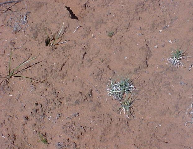
This looks like ordinary dirt but it is a biological soil crust (BSC), a living mantle of soil particles bound together by microbes and their by-products. BSCs are common to the arid and semiarid lands that make up about 40-percent of Earth’s total land mass. (Photo from Ferran Garcia-Pichel)
They lie dormant for years, but at the first sign of favorable conditions they awaken. This sounds like the tagline for a science fiction movie, but it describes the amazing life-cycles of microbial organisms that form the biological soil crusts (BSCs) of Earth’s deserts. Now a research team with the U.S. Department of Energy (DOE)’s Lawrence Berkeley National Laboratory (Berkeley Lab) has reported a unique molecular-level analysis of a BSC cyanobacterium responding to the wetting and drying of its environment. The results hold implications for land management, improved climate change models, and a better understanding of carbon cycling in soil microbial communities and how changes in global temperatures impact Earth’s deserts.
“We found a way to measure from start to finish in real unaltered samples the molecular events behind the response of cyanobacterium to wetting and drying in a desert BSC,” says Aindrila Mukhopadhyay, a biologist with Berkeley Lab’s Physical Biosciences Division. “Not only did we get a good view of the genetic machinery that wakes the microbes up, but we also got a good sense of what constitutes a healthy BSC.”
Mukhopadhyay and Trent Northen, a chemist with Berkeley Lab’s Life Sciences Division, are the corresponding authors of a paper describing this research in the journal of the International Society for Microbial Ecology. The paper is titled “Dynamic cyanobacterial response to hydration and dehydration in a desert biological soil crust.”
Arid and semi-arid deserts make up about 40-percent of Earth’s total land mass. Much of the undisturbed soil crust in these deserts is a living mantle of microbes and their by-products, with the predominant inhabitants being cyanobacteria, microorganisms that use photosynthesis for energy. To survive dry spells that can go on for years, BSC microorganisms must enter a dormant state but they must also be poised for rapid resuscitation to utilize short periods of precipitation. For a better understanding of how the microbes are able to do this, the Berkeley Lab research team studied the cyanobacteriumMicrocoleus vaginatus.
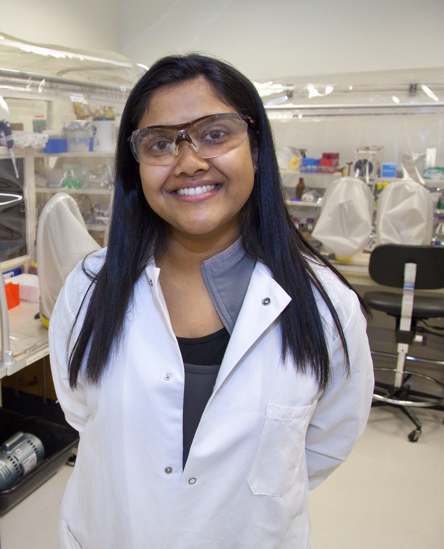
Aindrila Mukhopadhyay is a biologist with Berkeley Lab’s Physical Biosciences Division (Photo by Roy Kaltschmidt)
M. vaginatus is the early BSC colonizer, an ecosystem pioneer that fixes carbon and binds the soil together allowing the community to develop while preventing wind erosion,” says Northen. “It is globally distributed in regions where water is scarce, including not only hot deserts but the arctic as well.”
Working with the research group of Ferran Garcia-Pichel at Arizona State University, the Berkeley Lab team collected pie-sized samples of soil crust from the cold desert area near Moab, Utah. These samples were subjected to in situwetting and drying over a period of six days, including two diel (day/night) cycles. The wetting simulated conditions that would be brought about by the passage of a rain front. During the study, the researchers performed whole-genome transcriptional analysis and precise biochemical measurements.
“Simulated weather conditions and sampling in a temporal manner over the six day experimental period allowed us to track key transcriptional and metabolic responses as they occurred,” says Mukhopadhyay. “We found that within three minutes after wetting began, metabolic processes in the dormant microbial cells came alive. Within one hour, photosynthesis began, accompanied by carbon dioxide up-take. During this time we saw specific genes get turned on/off and specific gene expressions be elevated or depressed.”
The rain episode lasted three days. Although rare, such conditions do occur in the desert and enabled the researchers to differentiate between wetting-up and drying-down responses from diel cycle responses. They discovered that when dehydration of the soil resumed, the mechanisms triggered by wetting were mirrored in the reverse direction, suggesting that the M. vaginatus microbes were preparing themselves to re-enter desiccation-induced dormancy.
“These BSC microbes are highly attuned to their environment and they respond very quickly to changes,” Mukhopadhyay says. “Their responses, however, are highly sensitive to physical disturbances and alterations in temperature.”
In their paper, the Berkeley Lab researchers say that a better understanding of how environmental factors influence the growth and metabolism of M. vaginatus and other BSC microbes should improve our ability to predict the impacts of climate or land-use change on BSC systems. This knowledge should also help in the development of management strategies for restoring BSCs following large-scale disturbances.
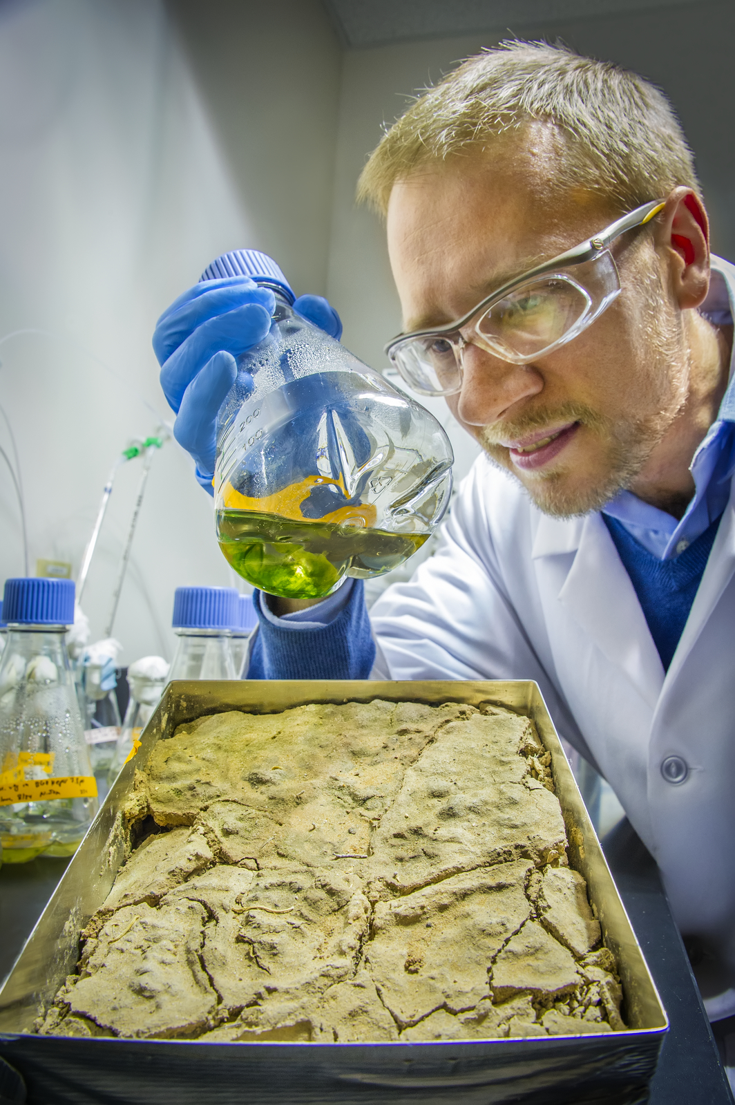
Trent Northen is a chemist with Berkeley Lab’s Life Sciences Division (Photo by Roy Kaltschmidt)
“BSC systems represent the world’s largest biofilms, and the demise of such systems could release carbon, and probably more importantly, dust into the atmosphere, changing the albedo of snow-packs,” says Northen. “Restoring or protecting BSCs through changes in land-use could help pull carbon out of the atmosphere and reduce dust.”
A better understanding of BSCs could also deepen our understanding of the carbon cycle, which could improve the accuracy of climate models, as Mukhopadhyay explains.
“In most climate models there is little or no accounting for the carbon fixed by soil microbes,” she says. “BSC cyanobacteria are the photosynthetic organism for deserts and understanding their role in the carbon-cycle will help fill in current climate model gaps. This should help improve the accuracy of these models.”
The Berkeley Lab team would like to expand their efforts to examine other BSC systems around the world. Among other issues, they would like to identify the signaling mechanisms that inform dormant BSC microbes that moisture is present or that the temperature is changing and it is time to respond.
“BSCs are sentinels for marking the health or decline of the world’s deserts, one of Earth’s major ecosystems,” Mukhopadhyay says. “It is vital that we understand them.”
Co-authoring the paper “Dynamic cyanobacterial response to hydration and dehydration in a desert biological soil crust” were Lara Rajeev, Ulisses Nunes da Rocha, Niels Klitgord, Eric Luning, Julian Fortney, Seth Axen, Patrick Shih, Nicholas Bouskill, Benjamin Bowen, Cheryl Kerfeld, Ferran Garcia-Pichel and Eoin Brodie.
This research was funded through Berkeley Lab’s Laboratory Directed Research and Development program.
#  #  #
Lawrence Berkeley National Laboratory addresses the world’s most urgent scientific challenges by advancing sustainable energy, protecting human health, creating new materials, and revealing the origin and fate of the universe. Founded in 1931, Berkeley Lab’s scientific expertise has been recognized with 13 Nobel prizes. The University of California manages Berkeley Lab for the U.S. Department of Energy’s Office of Science. For more, visit www.lbl.gov.
DOE’s Office of Science is the single largest supporter of basic research in the physical sciences in the United States, and is working to address some of the most pressing challenges of our time. For more information, please visit the Office of Science website atscience.energy.gov/.
Additional Information
A video of Aindrila Mukhopadhyay discussing aspects of her BSC research can be viewedhere