Search This Blog

Showing posts with label Earth sciences. Show all posts

Thursday, August 22, 2013

3D Earth model developed at Sandia Labs more accurately pinpoints source of earthquakes, explosions


AVG AntiVirus 2013


Sandia Labs News Releases


3D Earth model developed at Sandia Labs more accurately pinpoints source of earthquakes, explosions

Sandia offers free, standardized GeoTess software to public
ALBUQUERQUE, N.M. – During the Cold War, U.S. and international monitoring agencies could spot nuclear tests and focused on measuring their sizes. Today, they’re looking around the globe to pinpoint much smaller explosives tests.
Under the sponsorship of the National Nuclear Security Administration’s Office of Defense Nuclear Nonproliferation R&D, Sandia National Laboratories and Los Alamos National Laboratory have partnered to develop a 3-D model of the Earth’s mantle and crust called SALSA3D, or Sandia-Los Alamos 3D. The purpose of this model is to assist the US Air Force and the internationalComprehensive Nuclear-Test-Ban Treaty Organization (CTBTO) in Vienna, Austria, more accurately locate all types of explosions.
The model uses a scalable triangular tessellation and seismic tomography to map the Earth’s “compressional wave seismic velocity,” a property of the rocks and other materials inside the Earth that indicates how quickly compressional waves travel through them and is one way to accurately locate seismic events, Sandia geophysicist Sandy Ballard said. Compressional waves — measured first after seismic events — move the particles in rocks and other materials minute distances backward and forward between the location of the event and the station detecting it.
SALSA3D also reduces the uncertainty in the model’s predictions, an important feature for decision-makers who must take action when suspicious activity is detected, he added.
“When you have an earthquake or nuclear explosion, not only do you need to know where it happened, but also how well you know that. That’s a difficult problem for these big 3-D models. It’s mainly a computational problem,” Ballard said. “The math is not so tough, just getting it done is hard, and we’ve accomplished that.”
A Sandia team has been writing and refining code for the model since 2007 and is now demonstrating SALSA3D is more accurate than current models.
alt
Sandia National Laboratories researcher Sandy Ballard and colleagues from Sandia and Los Alamos National Laboratory have developed SALSA3D, a 3-D model of the Earth’s mantle and crust designed to help pinpoint the location of all types of explosions. (Photo by Randy Montoya) Click on the thumbnail for a high-resolution image.
In recent tests, SALSA3D was able to predict the source of seismic events over a geographical area that was 26 percent smaller than the traditional one-dimensional model and 9 percent smaller than a recently developed Regional Seismic Travel Time (RSTT) model used with the one-dimensional model.
GeoTess software release
Sandia recently released SALSA3D’s framework — the triangular tessellated grid on which the model is built — to other Earth scientists, seismologists and the public. By standardizing the framework, the seismological research community can more easily share models of the Earth’s structure and global monitoring agencies can better test different models. Both activities are hampered by the plethora of models available today, Ballard said. (See box.)
“GeoTess makes models compatible and standardizes everything,” he said. “This would really facilitate sharing of different models, if everyone agreed on it.”
Seismologists and researchers worldwide can now download GeoTess, which provides a common model parameterization for multidimensional Earth models and a software support system that addresses the construction, population, storage and interrogation of data stored in the model. GeoTess is not specific to any particular data, so users have considerable flexibility in how they store information in the model. The free package, including source code, is being released under the very liberal BSD Open Source License. The code is available in Java and C++, with interfaces to the C++ version written in C and Fortran90. GeoTess has been tested on multiple platforms, including Linux, SunOS, MacOSX and Windows. GeoTess is available here.
When an explosion goes off, the energy travels through the Earth as waves that are picked up by seismometers at U.S. and international ground monitoring stations associated with nuclear explosion monitoring organizations worldwide. Scientists use these signals to determine the location.
They first predict the time taken for the waves to travel from their source through the Earth to each station. To calculate that, they have to know the seismic velocity of the Earth’s materials from the crust to the inner core, Ballard said.
“If you have material that has very high seismic velocity, the waves travel very quickly, but the energy travels less quickly through other kinds of materials, so it takes the signals longer to travel from the source to the receiver,” he says.
For the past 100 years, seismologists have predicted the travel time of seismic energy from source to receiver using one-dimensional models. These models, which are still widely used today, account only for radial variations in seismic velocity and ignore variations in geographic directions. They yield seismic event locations that are reasonably accurate, but not nearly as precise as locations calculated with high fidelity 3-D models.
Modern 3-D models of the Earth, like SALSA3D, account for distortions of the seismic wavefronts caused by minor lateral differences in the properties of rocks and other materials.
For example, waves are distorted when they move through a geological feature called a subduction zone, such as the one beneath the west coast of South America where one tectonic plate under the Pacific Ocean is diving underneath the Andes Mountains. This happens at about the rate at which fingernails grow, but, geologically speaking, that’s fast, Ballard said.
One-dimensional models, like the widely used ak135 developed in the 1990s, are good at predicting the travel time of waves when the distance from the source to the receiver is large because these waves spend most of their time traveling through the deepest, most homogenous parts of the Earth. They don’t do so well at predicting travel time to nearby events where the waves spend most of their time in the Earth’s crust or the shallowest parts of the mantle, both of which contain a larger variety of materials than the lower mantle and the Earth’s core.
RSTT, a previous model developed jointly by Sandia, Los Alamos and Lawrence Livermore national laboratories, tried to solve that problem and works best at ranges of about 60-1,200 miles (100-2,000 kilometers).
Still, “the biggest errors we get are close to the surface of the Earth. That’s where the most variability in materials is,” Ballard said.
Seismic tomography gives SALSA3D accuracy
Today, Earth scientists are mapping three dimensions: the radius, latitude and longitude.
Anyone who’s studied a globe or world atlas knows that the traditional grid of longitudinal and latitudinal lines work all right the closer you are to the equator, but at the poles, the lines are too close together. For nuclear explosion monitoring, Earth models must accurately characterize the polar regions even though they are remote because seismic waves travel under them, Ballard said.
Triangular tessellation solves that with nodes, or intersections of the triangles, that can be accurately modeled even at the poles. The triangles can be smaller where more detail is needed and larger in areas that require less detail, like the oceans. Plus the model extends into the Earth like columns of stacked pieces of pie without the rounded crust edges.
The way Sandia calculates the seismic velocities uses the same math that is used to detect a tumor in an MRI, except on a global, rather than a human, scale.
Sandia uses historical data from 118,000 earthquakes and 13,000 current and former monitoring stations worldwide collected by Los Alamos Lab’s Ground Truth catalog.
“We apply a process called seismic tomography where we take millions of observed travel times and invert them for the seismic velocities that would create that data set. It’s mathematically similar to doing linear regression, but on steroids,” Sandy says. Linear regression is a simple mathematical way to model the relationship between a known variable and one or more unknown variables. Because the Sandia team models hundreds of thousands of unknown variables, they apply a mathematical method called least squares to minimize the discrepancies between the data from previous seismic events and the predictions.
With 10 million data points, Sandia uses a distributed computer network with about 400 core processors to characterize the seismic velocity at every node.
Monitoring agencies could use SALSA3D to precompute the travel time from each station in their network to every point on Earth. When it comes time to compute the location of a new seismic event in real-time, source-to-receiver travel times can be computed in a millisecond and pinpoint the energy’s source in about a second, he said.
Uncertainty modeling a SALSA3D feature
But no model is perfect, so Sandia has developed a way to measure the uncertainty in each prediction SALSA3D makes, based on uncertainty in the velocity at each node and how that uncertainty affects the travel time prediction of each wave from a seismic event to each monitoring station.
SALSA3D estimates for the users at monitoring stations the most likely location of a seismic event and the amount of uncertainty in the answer to help inform their decisions.
International test ban treaties require that on-site inspections can only occur within a 1,000-square-kilometer (385-square-mile) area surrounding a suspected nuclear test site. Today, 3-D Earth models like SALSA3D are helping to meet and sometimes significantly exceed this threshold in most parts of the world.
“It’s extremely difficult to do because the problem is so large,” Ballard said. “But we’ve got to know it within 1,000 square kilometers or they might search in the wrong place.”

Sandia National Laboratories is a multi-program laboratory operated by Sandia Corporation, a wholly owned subsidiary of Lockheed Martin company, for the U.S. Department of Energy’s National Nuclear Security Administration. With main facilities in Albuquerque, N.M., and Livermore, Calif., Sandia has major R&D responsibilities in national security, energy and environmental technologies and economic competitiveness.

Computer Simulations Indicate Calcium Carbonate Has a Dense Liquid Phase


AVG AntiVirus 2013


Berkeley Lab research could help scientists predict how carbon is stored underground

AUGUST 22, 2013
Dan Krotz 510-486-4019  dakrotz@lbl.gov
News Release
red2
Artistic rendition of liquid-liquid separation in a supersaturated calcium carbonate solution. New research suggests that a dense liquid phase (shown in red in the background and in full atomistic detail based on computer simulations in the foreground) forms at the onset of calcium carbonate crystallization. (Credit: Berkeley Lab)
Computer simulations conducted at the U.S. Department of Energy’s Lawrence Berkeley National Laboratory (Berkeley Lab) could help scientists make sense of a recently observed and puzzling wrinkle in one of nature’s most important chemical processes. It turns out that calcium carbonate—the ubiquitous compound that is a major component of seashells, limestone, concrete, antacids and myriad other naturally and industrially produced substances—may momentarily exist in liquid form as it crystallizes from solution.
Calcium carbonate is a huge player in the planet’s carbon cycle, so any new insight into how it behaves is potentially big news. The prediction of a dense liquid phase during the conversion of calcium carbonate to a solid could help scientists understand the response of marine organisms to changes in seawater chemistry due to rising atmospheric CO2 levels. It could also help them predict the extent to which geological formations can act as carbon storage reservoirs, among other examples.
The research is published in the August 23 issue of the journal Science. It was performed in support of the Center for Nanoscale Control of Geologic CO2, an Energy Frontier Research Center established at Berkeley Lab by the U.S. Department of Energy.

Recent molecular dynamics simulations suggest that under the right conditions, calcium carbonate may briefly exist in liquid form as it crystallizes. In this simulation, red and blue carbonate ions and yellow calcium ions come together in a dense liquid phase as a precursor to amorphous calcium carbonate. (Credit: Berkeley Lab)
The research may also reconcile some confounding experimental observations. For more than a century, scientists believed that crystals nucleate from solution by overcoming an energy barrier. But recent studies of calcium carbonate revealed the presence of nanoscopic clusters which, under certain conditions, appear to circumvent the barrier by following an alternative aggregation-based crystallization pathway.
“Because nucleation is ubiquitous in both natural and synthetic systems, those findings have forced diverse scientific communities to reevaluate their longstanding view of this process,” says the study’s co-corresponding author Jim De Yoreo, formerly of Berkeley Lab and now a scientist at Pacific Northwest National Laboratory.
The Berkeley Lab-led team used molecular dynamics simulations to study the onset of calcium carbonate formation. The simulations predict that in sufficiently supersaturated calcium carbonate solutions, nanoscale dense liquid droplets can spontaneously form. These droplets then coalesce to form an amorphous solid prior to crystallization.
The findings support the aggregation-based mechanism of calcium carbonate formation. They also indicate that the presence of the nanoscale phase is consistent with a process called liquid-liquid separation, which is well known in alloys and polymers, but unexpected for salt solutions.
“Our simulations suggest the existence of a dense liquid form of calcium carbonate,” says co-corresponding author Adam Wallace. He conducted the research while a post-doctoral researcher in Berkeley Lab’s Earth Sciences Division, and is now an assistant professor in the Department of Geological Sciences at the University of Delaware.
“This is important because it is an as-yet unappreciated component of the carbon cycle,” adds Wallace. “It also provides a means of explaining the unusual presence of nanoscale clusters in solution within the context of established physical mechanisms.”
This research was supported by the U.S. Department of Energy’s Office of Science through the Energy Frontier Research Center program established in 2009. The work was conducted at Berkeley Lab’s Molecular Foundry, a Department of Energy national user facility. The research also used resources of the Department of Energy’s National Energy Research Scientific Computing Center, which is located at Berkeley Lab.
###
The Molecular Foundry is one of five DOE Nanoscale Science Research Centers (NSRCs), national user facilities for interdisciplinary research at the nanoscale, supported by the DOE Office of Science.  Together the NSRCs comprise a suite of complementary facilities that provide researchers with state-of-the-art capabilities to fabricate, process, characterize and model nanoscale materials, and constitute the largest infrastructure investment of the National Nanotechnology Initiative.  The NSRCs are located at DOE’s Argonne, Brookhaven, Lawrence Berkeley, Oak Ridge and Sandia and Los Alamos National Laboratories.  For more information about the DOE NSRCs, please visit science.energy.gov.
Lawrence Berkeley National Laboratory addresses the world’s most urgent scientific challenges by advancing sustainable energy, protecting human health, creating new materials, and revealing the origin and fate of the universe. Founded in 1931, Berkeley Lab’s scientific expertise has been recognized with 13 Nobel prizes. The University of California manages Berkeley Lab for the U.S. Department of Energy’s Office of Science. For more, visit www.lbl.gov.
The DOE Office of Science is the single largest supporter of basic research in the physical sciences in the United States and is working to address some of the most pressing challenges of our time. For more information, please visit science.energy.gov.
Additional information:
•    The research, “Microscopic Evidence for Liquid-Liquid Separation in Supersaturated CaCO3 Solutions” is published in the August 23, 2013 issue of the journal Science.

Friday, June 14, 2013

Biological Soil Crust Secrets Uncovered


Berkeley Lab Team Reveals How Desert Cyanobacteria Awaken to Rainfall Then Resume Their Sleep

JUNE 14, 2013
Lynn Yarris (510) 486-5375  lcyarris@lbl.gov
 14 


Feature
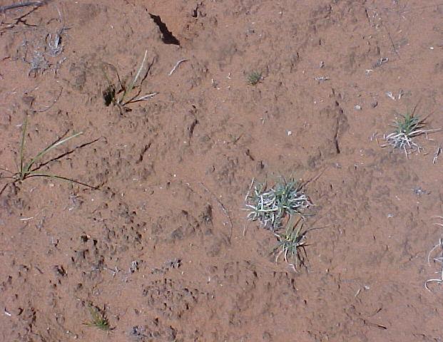
This looks like ordinary dirt but it is a biological soil crust (BSC), a living mantle of soil particles bound together by microbes and their by-products. BSCs are common to the arid and semiarid lands that make up about 40-percent of Earth’s total land mass. (Photo from Ferran Garcia-Pichel)
They lie dormant for years, but at the first sign of favorable conditions they awaken. This sounds like the tagline for a science fiction movie, but it describes the amazing life-cycles of microbial organisms that form the biological soil crusts (BSCs) of Earth’s deserts. Now a research team with the U.S. Department of Energy (DOE)’s Lawrence Berkeley National Laboratory (Berkeley Lab) has reported a unique molecular-level analysis of a BSC cyanobacterium responding to the wetting and drying of its environment. The results hold implications for land management, improved climate change models, and a better understanding of carbon cycling in soil microbial communities and how changes in global temperatures impact Earth’s deserts.
“We found a way to measure from start to finish in real unaltered samples the molecular events behind the response of cyanobacterium to wetting and drying in a desert BSC,” says Aindrila Mukhopadhyay, a biologist with Berkeley Lab’s Physical Biosciences Division. “Not only did we get a good view of the genetic machinery that wakes the microbes up, but we also got a good sense of what constitutes a healthy BSC.”
Mukhopadhyay and Trent Northen, a chemist with Berkeley Lab’s Life Sciences Division, are the corresponding authors of a paper describing this research in the journal of the International Society for Microbial Ecology. The paper is titled “Dynamic cyanobacterial response to hydration and dehydration in a desert biological soil crust.”
Arid and semi-arid deserts make up about 40-percent of Earth’s total land mass. Much of the undisturbed soil crust in these deserts is a living mantle of microbes and their by-products, with the predominant inhabitants being cyanobacteria, microorganisms that use photosynthesis for energy. To survive dry spells that can go on for years, BSC microorganisms must enter a dormant state but they must also be poised for rapid resuscitation to utilize short periods of precipitation. For a better understanding of how the microbes are able to do this, the Berkeley Lab research team studied the cyanobacteriumMicrocoleus vaginatus.
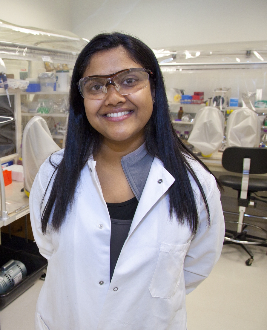
Aindrila Mukhopadhyay is a biologist with Berkeley Lab’s Physical Biosciences Division (Photo by Roy Kaltschmidt)
“M. vaginatus is the early BSC colonizer, an ecosystem pioneer that fixes carbon and binds the soil together allowing the community to develop while preventing wind erosion,” says Northen. “It is globally distributed in regions where water is scarce, including not only hot deserts but the arctic as well.”
Working with the research group of Ferran Garcia-Pichel at Arizona State University, the Berkeley Lab team collected pie-sized samples of soil crust from the cold desert area near Moab, Utah. These samples were subjected to in situwetting and drying over a period of six days, including two diel (day/night) cycles. The wetting simulated conditions that would be brought about by the passage of a rain front. During the study, the researchers performed whole-genome transcriptional analysis and precise biochemical measurements.
“Simulated weather conditions and sampling in a temporal manner over the six day experimental period allowed us to track key transcriptional and metabolic responses as they occurred,” says Mukhopadhyay. “We found that within three minutes after wetting began, metabolic processes in the dormant microbial cells came alive. Within one hour, photosynthesis began, accompanied by carbon dioxide up-take. During this time we saw specific genes get turned on/off and specific gene expressions be elevated or depressed.”
The rain episode lasted three days. Although rare, such conditions do occur in the desert and enabled the researchers to differentiate between wetting-up and drying-down responses from diel cycle responses. They discovered that when dehydration of the soil resumed, the mechanisms triggered by wetting were mirrored in the reverse direction, suggesting that the M. vaginatus microbes were preparing themselves to re-enter desiccation-induced dormancy.
“These BSC microbes are highly attuned to their environment and they respond very quickly to changes,” Mukhopadhyay says. “Their responses, however, are highly sensitive to physical disturbances and alterations in temperature.”
In their paper, the Berkeley Lab researchers say that a better understanding of how environmental factors influence the growth and metabolism of M. vaginatus and other BSC microbes should improve our ability to predict the impacts of climate or land-use change on BSC systems. This knowledge should also help in the development of management strategies for restoring BSCs following large-scale disturbances.
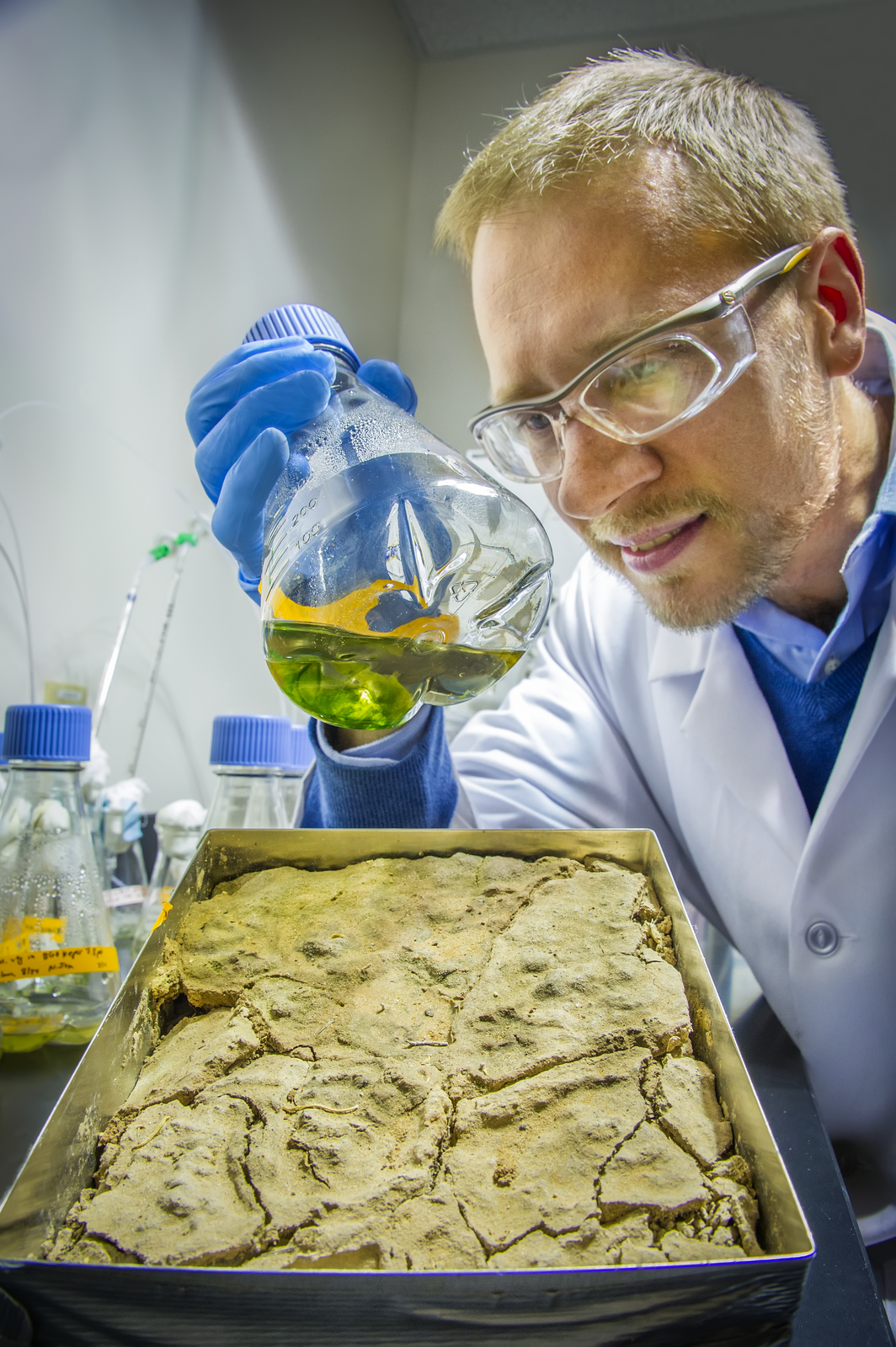
Trent Northen is a chemist with Berkeley Lab’s Life Sciences Division (Photo by Roy Kaltschmidt)
“BSC systems represent the world’s largest biofilms, and the demise of such systems could release carbon, and probably more importantly, dust into the atmosphere, changing the albedo of snow-packs,” says Northen. “Restoring or protecting BSCs through changes in land-use could help pull carbon out of the atmosphere and reduce dust.”
A better understanding of BSCs could also deepen our understanding of the carbon cycle, which could improve the accuracy of climate models, as Mukhopadhyay explains.
“In most climate models there is little or no accounting for the carbon fixed by soil microbes,” she says. “BSC cyanobacteria are the photosynthetic organism for deserts and understanding their role in the carbon-cycle will help fill in current climate model gaps. This should help improve the accuracy of these models.”
The Berkeley Lab team would like to expand their efforts to examine other BSC systems around the world. Among other issues, they would like to identify the signaling mechanisms that inform dormant BSC microbes that moisture is present or that the temperature is changing and it is time to respond.
“BSCs are sentinels for marking the health or decline of the world’s deserts, one of Earth’s major ecosystems,” Mukhopadhyay says. “It is vital that we understand them.”
Co-authoring the paper “Dynamic cyanobacterial response to hydration and dehydration in a desert biological soil crust” were Lara Rajeev, Ulisses Nunes da Rocha, Niels Klitgord, Eric Luning, Julian Fortney, Seth Axen, Patrick Shih, Nicholas Bouskill, Benjamin Bowen, Cheryl Kerfeld, Ferran Garcia-Pichel and Eoin Brodie.
This research was funded through Berkeley Lab’s Laboratory Directed Research and Development program.
#  #  #
Lawrence Berkeley National Laboratory addresses the world’s most urgent scientific challenges by advancing sustainable energy, protecting human health, creating new materials, and revealing the origin and fate of the universe. Founded in 1931, Berkeley Lab’s scientific expertise has been recognized with 13 Nobel prizes. The University of California manages Berkeley Lab for the U.S. Department of Energy’s Office of Science. For more, visit www.lbl.gov.
DOE’s Office of Science is the single largest supporter of basic research in the physical sciences in the United States, and is working to address some of the most pressing challenges of our time. For more information, please visit the Office of Science website atscience.energy.gov/.
Additional Information
A video of Aindrila Mukhopadhyay discussing aspects of her BSC research can be viewedhere