2012 Ag Census Web Maps tool helps you create a visual overview of data for U.S. farm demographics, economics, crops, and livestock.
Agricultural data are valuable for analysis, and thanks to the Census of Agriculture and other surveys, NASS has plenty of data available. As a cartographer, however, I obviously prefer to present the data in map form. A map gives anyone a chance to visualize data for multiple geographic areas as a cohesive image, providing a graphic overview of the agricultural phenomena. It also allows map readers to visually compare regions, and discern patterns and relationships in the data across regions, topics, and time.
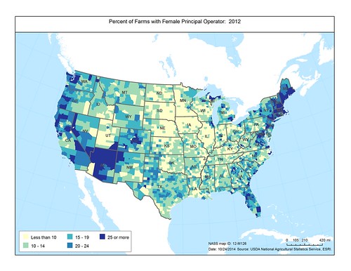
When it came to the ag census, for each of the past eight editions, NASS produced an atlas of thematic (statistical) maps illustrating various aspects of U.S. agriculture. While great for their time, with the evolution of digital technology, these paper maps are no longer sufficient on their own. The component missing from them is the data behind the maps, so what better way to depict and also convey a myriad of county-level statistics than through a web map application?
To address this issue, we decided to add a new web tool – Ag Census Web Maps application – which features numerous 2012 Census of Agriculture Atlas maps and also provides access to the data associated with the maps, along with an API for developers. This web map application enables users to interact with the maps – navigate to an area of interest, print a map or save an image of the area, select a county to view and extract its data, and download a spreadsheet containing all of the data for the maps.
There are some caveats, however. The published ag census data are summary statistics (totals), whereas, the maps present ratio values, which are in turn grouped into classes to create a visual representation of significant characteristics of U.S. agriculture. Also, keep in mind that some county data are not available to protect respondents’ confidentiality; however, every county on the map is represented by a class.
So if, like me, you are a visual person, the 2012 Ag Census Web Maps application and accompanying data let you see a complete picture of U.S. agriculture which is not available elsewhere. It is a great resource for exploring agricultural themes and data, and for using the maps and data with other mapping software and web services. And this is just the beginning as we plan on continuing to make new and innovative tools available.
No comments:
Post a Comment