The entrance to the Gates of Lodore on the Green River is stunningly colorful, even on a chilly December day.#nofilter #worththedrive #wilderness
#beautiful #beauty #colorful #desert #landscape #nature #natural #outdoor #Utah #UT
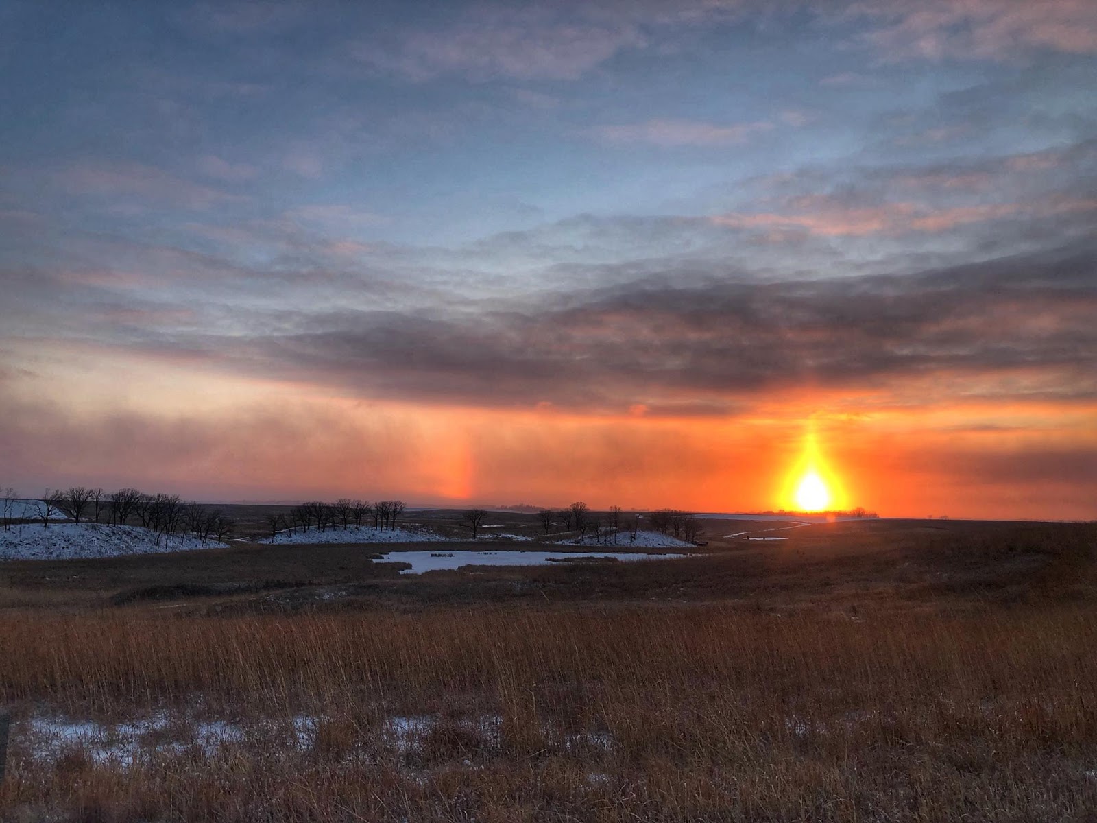
Sunset over the Edwards Waterfowl Production AreaAlex Galt/USFWS
#beautiful #beauty #landscape #minnesota #MN #SunriseAndSunset
What do badgers, corals, lions, pets, scorpions and doodlebugs have in common? According to Live Science, all are affected by the moon:http://bit.ly/2xkNaWQ 📷: Moonrise over frozen marshNorth Dakota's J. Clark Salyer Wetland Management District https://go.usa.gov/xn9wNBy Gary Eslinger/U.S. Fish and Wildlife Service
#beautiful #beauty #landscape #marsh #NorthDakota #ND
📷: Moonrise over frozen marshNorth Dakota's J. Clark Salyer Wetland Management District https://go.usa.gov/xn9wNBy Gary Eslinger/U.S. Fish and Wildlife Service
#beautiful #beauty #landscape #marsh #NorthDakota #ND
The work we do at Reclamation might vary from one day to the next. In today's Working Wednesday photo, Jeff Ticknor from the Great Plains Regional Office and Nathan Morgan from the Wyoming Area Office can be seen rappelling down the Yellowtail Dam during routine maintenance. To learn more about the exciting career opportunities available at Reclamation, visit: https://go.usa.gov/xnnNX
City lights are one of the most visible human impacts seen on Earth from space -- like this data image comparing changes in nighttime lights around Chicago. An instrument on the Suomi NPP satellite has been collecting data on the brightness of lights around the Earth since 2011, adding to an ever-growing archive of data that allows researchers to track changes on a global scale. Take a look:http://go.nasa.gov/2Cdgfop
#satellite #remotesensing
On this day in history...
Dec. 29, 1933: The St. Paul District awards a contract to W.W. Magee Company for the construction of the lock at Lock and Dam 9 in Lynxville, Wisconsin.
The Green River flows through the center of the Refuge. It provides riparian habitat for ducks, geese, swans, wrens, cliff and barn swallows, moose, beavers, and river otters.
The Diamond Breaks mountains loom in the background. These are mostly BLM Wilderness Study Area and provide habitat for elk and mule deer.
Photo Credit: Rachel Portwood — at Browns Park National Wildlife Refuge.
#nature #natural #outside #river
#Colorado #CO
New Island Made of Tuff StuffIn December 2014, a submarine volcano erupted violently in the South Pacific, sending superheated steam, ash, and rock 9 kilometers (30,000 feet) into the air. When the plume cleared and the ash settled in January 2015, a newborn island with a 120-meter (400-foot) summit was nestled between two older islands in the kingdom of Tonga.Unofficially known as Hunga Tonga-Hunga Ha’apai, the newly formed island was expected to last for just a few months. It now appears to have a 6- to 30-year lease on life, according to a NASA-led study.
Though the volcano is quite remote, satellite imagery has given scientists an unprecedented opportunity to observe the formation, erosion, and evolution of “surtseyan” islands. Surtsey rose from the seafloor off of Iceland in 1963 during an explosive submarine eruption. Only a few such eruptions have occurred in the modern scientific era (the past 150 years), and the 2015 event in Tonga is the first to be extensively observed by satellites. Understanding the processes that build and erode such islands on Earth could provide insights on similar features on Mars.
Surtseyan events are distinguished by chemical reactions that alter fragile and easily eroded volcanic rock into a tougher material—literally called “tuff.” In these highly explosive eruptions, seawater becomes superheated as it mixes with magma. It then rapidly converts to steam, expanding and fragmenting the magma into fine grains of ash. The result is a mass of rock that is much more like concrete than typical volcanic rock.
Since the emergence of Hunga Tonga-Hunga Ha’apai above the water line in 2015, it has been tracked regularly through satellite observations by optical sensors and radar (which can penetrate cloud cover in the often-cloudy tropics). NASA scientists were first alerted to the eruption when it was observed by the Moderate Resolution Imaging Spectroradiometer (MODIS) instruments on NASA satellites. A team of researchers then requested regular measurements and high-resolution images by a combination of government and commercial satellites.
Researchers assembled that data into three-dimensional maps of the island’s topography, its changing coastlines and area, and the volume of rock and ash above sea level. The analysis was presented on December 11, 2017, at the fall meeting of American Geophysical Union.
“Volcanic islands are some of the simplest landforms to make,” said first author Jim Garvin, chief scientist of NASA’s Goddard Space Flight Center. “Our interest is to calculate how much the three-dimensional landscape changes over time, particularly its volume, which has only been measured a few times at other such islands. It is the first step to understanding erosion rates and processes and deciphering why the island has persisted longer than most people expected.”
The images above were acquired in April 2015 and September 2017 by the Operational Land Imager on the Landsat 8 satellite. The animation below is a composite of images from several satellites, and it shows the evolution of the island. Note how the shape of Hunga Tonga-Hunga Ha’apai flattens and becomes less round over the years. The isthmus, or land bridge, between the new island and Hunga Tonga (to the northeast) also grows wider.
https://www.youtube.com/watch?v=sIXyxvSEKFY
The team has calculated two scenarios for the future of the island. The first includes accelerated erosion by waves, which could destabilize the tuff cone in six to seven years, leaving only the land bridge between the two adjacent, older islands. The second scenario presumes a slower erosion rate and leaves the tuff cone intact for about 25 to 30 years.
The most dramatic changes to the island occurred in its first six months. “Those cliffs of volcanic ash are pretty unstable,” said remote sensing specialist and co-author Dan Slayback of NASA Goddard. In early May 2015, the Pacific Ocean washed over the southeastern rim of the interior crater wall, opening the crater lake to the ocean. At that point, both Garvin and Slayback thought the island might rapidly disappear. But by June 2015, a sandbar had formed and closed off the crater lake. While the island continued to evolve, it became more stable by late 2015. Wave action has slowly redistributed eroded sediment from receding cliffs on the southern side of the island, forming and shoring up the isthmus to Hunga Tonga.
The new island and its older neighbors are perched on the north rim of the caldera of a much larger underwater volcano. According to bathymetry measurements led by geologist and co-author Vicki Ferrini of the Lamont-Doherty Earth Observatory, the entire volcanic complex rises nearly 1,400 meters (4,593 feet) from the sea floor. Underwater, the base of the new volcanic dome extends about 1 kilometer (0.6 miles) from the shoreline into the floor of the larger caldera, which is about 5 kilometers (3 miles) across. In the shallows close to the southern side of island, the seafloor levels out into a nearly flat shelf, which may help explain the persistence of the new tuff cone and the redistribution for the eroded material.
Evidence of past eruptions from other, smaller domes are also apparent around the rim of the caldera, though few break the surface. “There’s a huge amount of material that came out from this eruption, possibly larger than at Surtsey,” said Ferrini. “The other interesting thing is that the two islands that surround this new land mass have some pretty tough substrate, so there’s something happening chemically to help make this solidify and stay in place.”
https://www.youtube.com/watch?v=Hds1OBxVg4s
Garvin and Ferrini and colleagues will continue to track the new island. They also hope to assemble a detailed chemical analysis of rock samples from the site.
The Tongan island could help researchers understand volcanic features on Mars that look similar. “Everything we learn about what we see on Mars is based on the experience of interpreting Earth phenomena,” Garvin said. “We think there were eruptions on Mars at a time when there were areas of persistent surface water. We may be able to use this new island and its evolution as a way of testing whether any of those represented an oceanic environment or ephemeral lake environment.”
NASA Earth Observatory images by Jesse Allen, using Landsat data from the U.S. Geological Survey. Story by Ellen Gray, with Mike Carlowicz.
Read More at:
https://landsat.visibleearth.nasa.gov/view.php?id=91412
and/or
http://earthobservatory.nasa.gov/IOTD/view.php?id=91412&src=ve
#Landsat #NASA #USGS #Earth
#satellite
Under the midnight Sun, shattered fragments of a new iceberg calved from the Pine Island Glacier in Antarctica are seen from one of our NASA Earth observing satellites. Details:http://go.nasa.gov/2BTI95N
#satellite
Cape Horn: A Mariner’s NightmareBefore the opening of the Panama Canal in 1914, Cape Horn was a place that gave mariners nightmares. The waters off this rocky point, at the southern tip of Chile’s Tierra del Fuego peninsula, pose a perfect storm of hazards.Southwest of Cape Horn, the ocean floor rises sharply from 4,020 meters (13,200 feet) to 100 meters (330 feet) within a few kilometers. This sharp difference, combined with the potent westerly winds that swirl around the Furious Fifties, pushes up massive waves with frightening regularity. Add in frigid water temperatures, rocky coastal shoals, and stray icebergs—which drift north from Antarctica across the Drake Passage—and it is easy to see why the area is known as a graveyard for ships.
On July 12, 2014, the Operational Land Imager (OLI) on Landsat 8 satellite captured this image of Cape Horn and the Wollaston and Hermite Islands.
Hundreds of ships have gone down near Cape Horn since Dutchman Willem Schouten, a navigator for the Dutch East India Company, first charted a course around the Horn in 1616. One vessel that narrowly escaped that fate was the HMS Beagle, with naturalist Charles Darwin aboard. In The Voyage of the Beagle, Darwin described the harrowing journey as the explorers tried to round the Horn just before Christmas 1832.
December 21st. — The Beagle got under way: and on the succeeding day, favored to an uncommon degree by a fine easterly breeze, we closed in with the Barnevelts, and running past Cape Deceit with its stony peaks, about three o'clock doubled the weather-beaten Cape Horn. The evening was calm and bright, and we enjoyed a fine view of the surrounding isles.
Cape Horn, however, demanded his tribute, and before night sent us a gale of wind directly in our teeth. We stood out to sea, and on the second day again made the land, when we saw on our weather-bow this notorious promontory in its proper form—veiled in a mist, and its dim outline surrounded by a storm of wind and water.
Great black clouds were rolling across the heavens, and squalls of rain, with hail, swept by us with such extreme violence, that the Captain determined to run into Wigwam Cove. This is a snug little harbor, not far from Cape Horn; and here, at Christmas-eve, we anchored in smooth water. The only thing which reminded us of the gale outside, was every now and then a puff from the mountains, which made the ship surge at her anchors.
NASA Earth Observatory image by Jesse Allen, using Landsat data from the U.S. Geological Survey. Story by Adam Voiland.
Read More at:
https://landsat.visibleearth.nasa.gov/view.php?id=91472
and/or
http://earthobservatory.nasa.gov/IOTD/view.php?id=91472&src=ve
#Landsat #NASA #USGS #Earth
QUOTE OF THE WEEKYesterday is history. Tomorrow is a mystery. And today? Today is a gift. That's why we call it the present. -Babatunde Olatunji Best Holiday Wishes from #RMNP! (file photo NPS/Olsen) ks
#beauty #beautiful #earth #mountains #nature #natural #NationalPark #park
#RockyMountains
It’s almost time for a new week. As you prepare for Monday and the Christmas Holiday, take a minute and enjoy this Scenic Sunrise photo of the All American Canal in sunny California.
Happy holidays from the Bighorn Canyon National Recreation Area staff!!Photo by Midwest NPS
Although Gila Cliff Dwellings will be closed on Monday, December 25th, we want to wish you all the Happiest of Holidays. The Monument and Visitor Center will be open from December 26th through the 31st. Come celebrate the season in style!